Yazılar

Rise in Solar Activity Leads to Reduced Lifespan of Binar CubeSats

Surge in Solar Activity Cuts Short Lifespan of Binar CubeSats
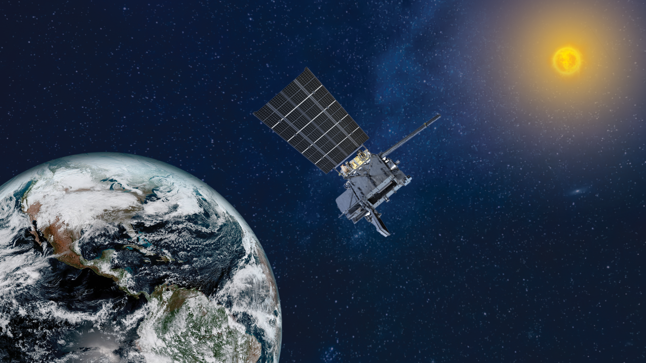
Three small satellites from Curtin University’s Binar Space Program re-entered Earth’s atmosphere far earlier than anticipated, prematurely ending their research missions. The CubeSats—Binar-2, Binar-3, and Binar-4—were designed with an initial lifespan of six months but only lasted two months in low Earth orbit (LEO). This early re-entry is attributed to a surge in solar activity that intensified conditions in space and affected satellite operations in ways that were not fully predicted.

Unprecedented Solar Activity Surpasses Predictions
Solar activity recently spiked, surpassing predictions by a significant margin, according to a Live Science report. The intensity of solar flares, sunspots, and solar wind has been about one and a half times higher than expected for Solar Cycle 25. This increase in solar activity is linked to the Sun’s 11-year magnetic field reversal, which influences space weather patterns. Despite advances in understanding solar cycles, forecasting solar weather remains difficult, making it challenging for satellite operators to predict the effects of these surges on space-based technology.

Impact of Solar Weather on Space Operations
The heightened solar activity has had a noticeable impact on space operations. On Earth, it has resulted in more vivid auroras visible closer to the equator, and the increased solar wind has contributed to higher levels of ionizing radiation, posing risks for astronauts and high-altitude flights. For satellites in low Earth orbit, particularly those like the Binar CubeSats without thrusters or altitude control systems, the solar wind creates additional drag, hastening orbital decay. These factors significantly shorten the operational lifespan of satellites in LEO during periods of high solar activity.

Challenges in Satellite Longevity and Space Weather Monitoring
The premature demise of the Binar CubeSats underscores the challenges posed by unpredictable space weather, particularly during solar cycle peaks. While satellites in LEO are more vulnerable to such conditions, the lack of reliable forecasting tools makes it difficult to fully prepare for or mitigate these effects. As solar activity continues to intensify, there is a growing need for advanced space weather forecasting and better shielding technologies to protect satellites, ensuring longer mission durations and more successful research outcomes.

NASA’s Atmospheric Waves Experiment Detects Gravity Waves Triggered by Hurricane Helene Over Florida

On September 26, 2024, as Hurricane Helene unleashed its fury on Florida’s Gulf Coast, NASA’s Atmospheric Waves Experiment (AWE) aboard the International Space Station (ISS) captured a remarkable atmospheric phenomenon. The storm, which produced intense storm surges and affected communities along the coast, created gravity waves high above the Earth’s surface, approximately 55 miles in altitude. These waves, a rare sight from space, were detected as part of NASA’s ongoing research into space weather and its interactions with Earth-bound systems such as satellites, communication networks, and other technological infrastructure.

The AWE instrument, which was launched in November 2023, is designed to observe the impact of terrestrial weather events on the upper atmosphere. As the ISS passed over the southeastern United States during the height of Hurricane Helene, the AWE detected large, concentric gravity waves caused by the extreme conditions below. The waves, which are visually represented in red, yellow, and blue hues, illustrate changes in radiance within Earth’s mesosphere, offering a striking depiction of how violent weather events can send shockwaves into the higher layers of the atmosphere. The color enhancements in the imagery highlight variations in infrared brightness, helping to track the waves as they stretched westward from northern Florida.

Gravity waves, which are essentially ripples in the atmosphere caused by disturbances such as strong winds or storms, have a significant role in both weather and space weather dynamics. According to Ludger Scherliess, the Principal Investigator for NASA’s AWE at Utah State University, these waves are similar to the ripples that form when a pebble is dropped into a pond. By studying these atmospheric disturbances, scientists can gain a deeper understanding of how terrestrial weather phenomena, like hurricanes, influence the broader atmospheric system, including conditions that can affect satellite operations and communication systems in space.

This discovery underscores the critical role of atmospheric studies in understanding the intricate relationship between weather on Earth and space weather. The data collected by NASA’s AWE could potentially provide valuable information for improving the resilience of space-based technology during extreme weather events, highlighting the interconnectedness of our planet’s weather systems and the technology that relies on them. As scientists continue to monitor these gravity waves, it could open new pathways for protecting both terrestrial and space-based infrastructure from the effects of powerful storms like Hurricane Helene.

First Images of Solar Eruptions Captured by NOAA’s GOES-19 Satellite

The National Oceanic and Atmospheric Administration (NOAA) has revealed the first images from its advanced space-based tool, the Compact Coronagraph (CCOR-1), mounted on the GOES-19 satellite. This instrument marks a milestone in solar observation, offering unprecedented clarity in monitoring solar activity. The CCOR-1’s role is to observe the sun’s outer atmosphere, known as the corona, and to track solar phenomena such as coronal mass ejections (CMEs), which can impact space weather on Earth.

Launched in June 2024, CCOR-1 officially began its solar observation mission on September 19, aiming to enhance our understanding of solar storms. These powerful eruptions can release massive bursts of energy and charged particles into space, potentially disrupting satellite communications, power grids, and GPS systems. Positioned on the GOES-19 satellite, which orbits Earth in a geostationary orbit, CCOR-1 provides a constant, real-time stream of data that is crucial for improving space weather forecasting.

What sets CCOR-1 apart from previous solar observation tools is its ability to block the sun’s intense glare using an occulting disk. This allows the coronagraph to capture high-resolution images of solar eruptions, such as CMEs, without being overwhelmed by the sun’s brightness. One of the most striking images captured on September 29 shows a CME bursting from the sun’s eastern limb at 8:15 a.m. EDT. The high-speed plasma streams from the sun’s surface, with speeds reaching up to thousands of miles per second, offering scientists a closer look at the dynamics of solar storms.

These groundbreaking images not only provide a clearer understanding of solar activity but also represent a significant leap in space weather forecasting. With real-time monitoring and detailed observations, CCOR-1 will help NOAA predict the potential impact of solar storms on Earth’s magnetic field and technological infrastructure. This advancement is a vital step forward in protecting both space-based assets and ground-based systems from the disruptive effects of solar weather.