Yazılar

NASA Satellite Identifies Tree Leaf Variations as Potential Early Indicator of Volcanic Eruptions

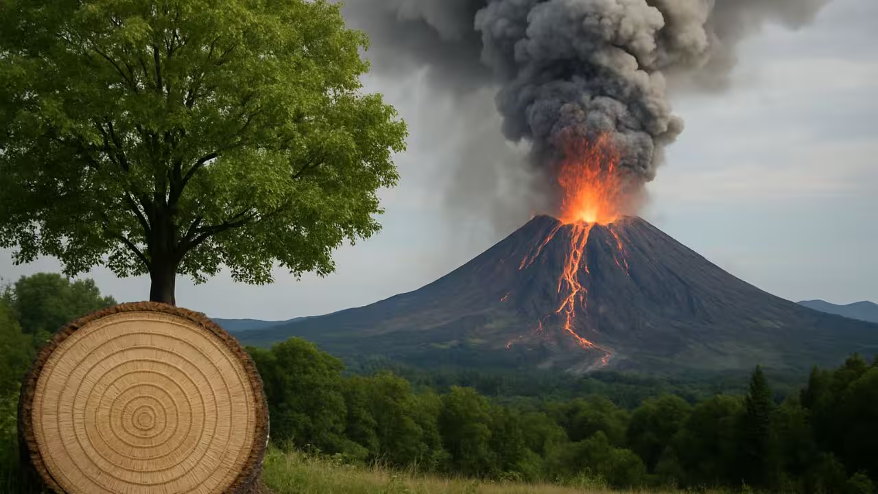
NASA scientists are exploring a novel method to predict volcanic eruptions by observing how trees respond to underground volcanic activity from space. In collaboration with the Smithsonian Institution, researchers have found that tree leaves tend to grow lusher and greener when volcanic carbon dioxide seeps through the soil, signaling magma movement beneath the surface. This natural reaction offers a promising early warning sign, potentially visible via satellites like Landsat 8 and recent missions such as AVUELO, providing an additional tool to monitor high-risk volcanoes worldwide.

According to research from NASA’s Earth Science Division at Ames Research Center, the greening of vegetation is triggered when trees absorb volcanic carbon dioxide released as magma pushes upward. Unlike sulfur dioxide, which appears later in volcanic activity and is easier to detect, carbon dioxide emissions are more challenging to observe directly from orbit. However, the indirect effect on vegetation health serves as a valuable clue to detect early stages of volcanic unrest.

Volcanologist Florian Schwandner highlights that these subtle changes in vegetation can complement existing early warning systems, particularly in remote or dangerous volcanic regions. Since on-site gas measurements can be risky and expensive, scientists like Robert Bogue and Nicole Guinn have begun investigating how tree leaf characteristics might serve as natural indicators of underground volcanic processes. Guinn’s studies around Mount Etna in Sicily demonstrated a strong link between leaf color shifts and subterranean volcanic gas emissions, with satellites like Sentinel-2 and Terra able to capture these vegetative changes effectively.

To validate this approach further, NASA and Smithsonian teams, led by climate scientist Josh Fisher, conducted fieldwork in early 2025 near active volcanoes in Panama and Costa Rica. They collected tree samples and measured gas levels to better understand the connection between vegetation response and volcanic activity. This interdisciplinary research not only aims to improve volcanic eruption forecasting but also promises insights into how long-term exposure to atmospheric carbon dioxide affects trees—information crucial for anticipating future climate dynamics.

Greenland’s Glaciers Shrink, Revealing 1,620 km of New Coastline Since 2000

Greenland’s rapidly melting glaciers have revealed an astounding 1,620 kilometers of previously ice-covered coastline over the past two decades. As Arctic marine-terminating glaciers continue to retreat, satellite imagery from 2000 to 2020 has documented this significant shift, showcasing the broader impacts of global warming on the region’s geography. These changes not only highlight the shrinking ice flows but also bring forth newly exposed land that is now open to environmental shifts. The newly uncovered areas are likely to face various ecological challenges, including shifts in local ecosystems and sediment movement, while simultaneously presenting opportunities for further scientific exploration.

A study published in Nature Climate Change examined satellite images to track the changes in glacier coverage across the northern hemisphere. The results showed that over the past 20 years, 2,466 kilometers of Arctic coastline have been revealed by glacial retreat, with Greenland accounting for approximately 66 percent of that total. One of the most striking examples of this phenomenon is the Zachariae Isstrom glacier, where 81 kilometers of coastline have been exposed, marking the most significant glacial retreat in the Arctic—twice the amount of any other glacier in the region.

In addition to the coastline, the melting glaciers have led to the discovery of new islands, some of which were previously hidden beneath the ice. The study found that 35 islands larger than 0.5 square kilometers have emerged as a result of the ice retreat, with 29 of these islands located in Greenland. Some of these newly uncovered islands have never been shown on any maps, raising concerns over potential territorial claims. As nations vie for control over these newly exposed lands, there are concerns about the rush to stake claims due to the region’s natural resources.

The emergence of these islands is not only a matter of political interest but also scientific curiosity. Researchers highlight the significant potential for studying the Arctic’s unique geology and marine ecosystems, with the newly exposed areas providing fresh insights into the region’s environmental history and biodiversity. These shifting landscapes offer an unprecedented opportunity for understanding the Arctic’s rapidly changing environment, but they also underscore the larger consequences of climate change on global ecosystems and geopolitical dynamics.

SpaceX’s Rise Under Trump 2.0 Welcomed by Asia’s No. 1 Satellite Company

For SKY Perfect JSAT (9412.T), Asia’s leading satellite company, the rise of Elon Musk’s SpaceX under the second Donald Trump presidency is not seen as a challenge but rather as an opportunity, according to the company’s president, Eiichi Yonekura. The Japanese firm plans to deepen its relationship with SpaceX, especially after announcing a $230 million investment in Planet Labs’ low-Earth orbit satellite Pelican, aimed at expanding its satellite imagery business.

Yonekura emphasized that the rapid advancements of SpaceX have been instrumental to the growth of JSAT, citing the company’s reliance on SpaceX rockets to launch its satellites into space. He added that the relationship has been beneficial, as the company is “probably the biggest SpaceX customer in Asia” and is set to expand its satellite operations with the launch of Planet Labs’ Pelicans, which will use SpaceX’s Falcon 9 for their deployments.

Musk’s close ties with Trump are also believed to have had an influence on U.S. space policies, with a stronger emphasis on Mars exploration. Reports suggest that the Trump administration may eliminate the National Space Council, a move that could potentially benefit SpaceX due to Musk’s lobbying efforts.

JSAT, which operates 17 geosynchronous communication satellites—the largest fleet in Asia—plans to enter the low-orbit satellite business by constructing a constellation of 10 Planet Pelicans by 2027. The company aims to generate 23 billion yen ($151 million) in revenue from satellite data services by fiscal year 2030, primarily from national security clients.

SpaceX’s development of the reusable Falcon 9 booster has revolutionized the cost structure of satellite launches, helping to lower costs significantly. While JSAT currently depends heavily on SpaceX for launches, Yonekura noted that if access to SpaceX boosters were to be restricted, JSAT would consider working with long-time European partner Arianespace or Japan’s Mitsubishi Heavy Industries, whose H3 rocket is expected to become competitive within the next four to five years.