
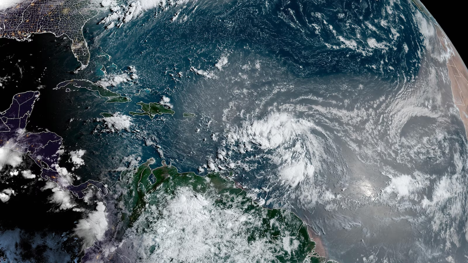
Tropical Storm Ernesto is currently battering the northern Caribbean with heavy rain, strong winds, and rough seas, as it makes its way toward Puerto Rico. The storm, which formed on Monday evening, passed close to Guadeloupe early Tuesday and is now moving through the Leeward Islands in the northeastern Caribbean.
With sustained winds of 45 mph and gusts reaching higher speeds, Ernesto is advancing westward at 18 mph. The storm’s influence is far-reaching, with tropical storm-force winds extending well beyond its center. Saint Barthélemy, located over 100 miles away from Ernesto’s core, experienced wind gusts of 56 mph.
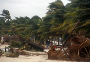
As the storm progresses, tropical storm warnings have been issued for Puerto Rico, the Leeward Islands, and the US and British Virgin Islands. The combination of Ernesto’s winds and rain poses a significant threat, with the potential for structural damage, downed trees, and power outages across the region.
The most serious concern, however, is the risk of heavy rainfall, which could lead to flash flooding and mudslides, particularly in Puerto Rico. The island is expected to receive 4 to 6 inches of rain, with some areas potentially seeing up to 10 inches, especially in the higher terrain of eastern and southern Puerto Rico. The deluge is expected to begin Tuesday evening, with the heaviest rain falling through late Wednesday.
Ernesto’s winds will also bring dangerous seas and storm surges of up to 3 feet, further threatening the islands in its path. In Puerto Rico, where the power grid remains fragile following the devastation of Hurricane Maria in 2017, officials have activated the National Guard and canceled public school classes in anticipation of widespread power outages.
The storm is expected to make a gradual turn northward on Wednesday, pulling away from the Caribbean and into the open Atlantic. Once over the warm waters of the Atlantic, Ernesto is likely to strengthen, potentially becoming a hurricane by late Wednesday night. There is a possibility that Ernesto could reach Category 3 strength or higher later in the week.
However, the exact path of the storm remains uncertain. If Ernesto turns north later than expected, it could impact areas farther west, such as Hispaniola or the southern Bahamas. As the storm moves further into the Atlantic, it could also pose a threat to Bermuda by the weekend, although the extent of its impact there is still unknown.
Even as Ernesto moves out to sea, its effects will be felt over a wide area, with rough seas and dangerous rip currents expected along the US East Coast, the Bahamas, and parts of the Caribbean into early next week.